
مشاور امنیت ملی آمریکا گفت کمک به اسرائیل، آن را قادر میسازد تا با حملات ایران و عوامل آن مقابله کند.
Read More “سالیوان به اسرائیل کمک می کنیم تا با حملات ایران مقابله کند” »
اطلاعات عمومی،سرگرمی،روانشناسی،پزشکی،گردشگری،طب سنتی
مشاور امنیت ملی آمریکا گفت کمک به اسرائیل، آن را قادر میسازد تا با حملات ایران و عوامل آن مقابله کند.
Read More “سالیوان به اسرائیل کمک می کنیم تا با حملات ایران مقابله کند” »
منبع خبر: خبر گزاری ایسناآخرین اخبار,پربازدید ترین اخبار, اخبار روز

ماموران پلیس آگاهی تهران بزرگ فردی را که با سوءاستفاده از احساسات زنانی که به تازگی مادر خود را از دست داده بود، اقدام به جلب اعتماد و اخاذی از آنان کرده بود، بازداشت کردند.
Read More “اخاذی مرد شیاد با جلب اعتماد زنان پس از مرگ مادرشان” »

از هشدار متخصصان درباره همهگیریِ بعدی جهانی گرفته تا ثبت رکورد روزهای داغِ اروپا در ۲۰۲۳ از جمله مهمترین اخبار و رویدادهای جهان در حوزه اجتماعی طی یک هفته گذشته بودند.
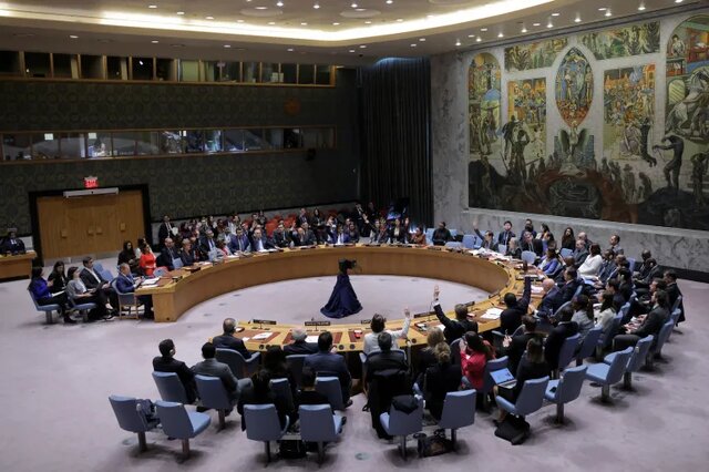
روسیه پیشنویس قطعنامه تحت حمایت آمریکا و ژاپن که خواستار عدم توسعه تسلیحات هستهای جهت استقرار در فضا میشد را وتو کرد.
Read More “روسیه پیش نویس قطعنامه آمریکا درباره استقرار تسلیحات هسته ای” »

اختلاف میان عموهای فیتیلهای با مجید قناد (عمو قناد) که به بیش از یک دهه پیش برمی گردد، این روزها با یک گفت و گوی تلویزبونی در فضای رسانه تازه شده است.
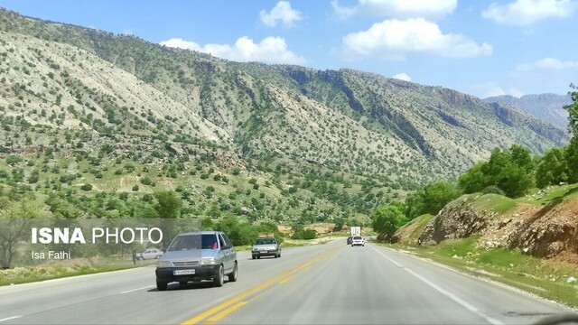
ایسنا/لرستان مدیرکل راهداری و حمل و نقل جاده ای استان لرستان گفت: در فروردین ماه سال جاری متوسط تردد بین استانی ۲ میلیون و ۹۴۹ و ۷۰۳ وسیله نقلیه ثبت شده، که نسبت به مدت مشابه سال گذشته ۱۳ درصد افزایش داشته است.
Read More “افزایش ۱۳ درصدی تردد خودروها در جاده های لرستان” »

مردم آمریکا به شدت در مورد جنگ اسرائیل در غزه اختلاف نظر دارند.
Read More “دانشگاه کلمبیا چطور به مرکز اختلافات در مورد جنگ غزه تبدیل شد” »
ایسنا/سیستان و بلوچستان معاون سیاسی و اجتماعی استاندار سیستان و بلوچستان گفت: معدل سیستان و بلوچستان در زمینه توسعه رو به رشد بوده و تیم استان تیم مقتدری است و ابقای مدیران بسته به رضایت مردم است و ما مدیران را براساس نظر مردم ارزیابی میکنیم.
Read More “معدل سیستان و بلوچستان در زمینه توسعه رو به رشد است” »